You Won’t Believe How These 10 American Ghost Towns Once Were

You Won’t Believe How These 10 American Ghost Towns Once Were

Larry Holzwarth - February 9, 2018

Ghost towns conjure the image in the mind’s eye of abandoned towns of the Old West, with eerily swinging saloon doors, myriads of broken windows, and tumbleweeds rolling in the dust. That’s one type of ghost town, but America is liberally dotted with others, in all of the contiguous states. Some were abandoned because the railroad and later interstate highways passed them by. Some were left because the main source of employment went away. Others were abandoned because of repeated floods, or other disasters which made them untenable. Underground coal fires created abandoned towns in Pennsylvania, and since the fire still burns uncontrollably beneath the surface, will likely create others before it burns itself out.

The building of dams often creates ghost towns, many of them submerged after completion of the dam. Some have moved and reorganized themselves on higher ground or other suitable location. The real estate mantra – location, location, location – has been the justification for one site to be abandoned for another. The first English settlement in North America, Jamestown, was abandoned when the settlement at Middle Plantation, renamed Williamsburg, was declared the Virginia Colony’s capital. Many of the ghost towns in the United States are reachable with relative ease, ready to be explored by those so inclined.

You Won’t Believe How These 10 American Ghost Towns Once Were
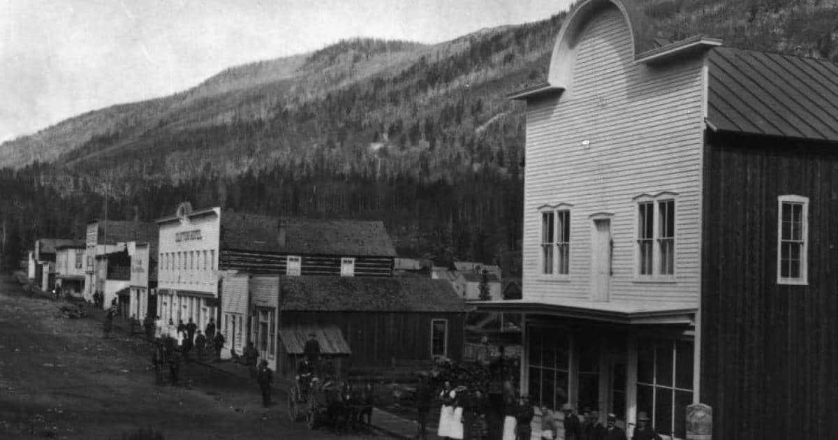
Although Virginia City Nevada is another famous ghost town, this one is Virginia City, Montana. Wikimedia

Here are ten American ghost towns which offer the curious an interesting place to visit.

You Won’t Believe How These 10 American Ghost Towns Once Were
The abandoned canal store at Frick’s Lock with the Limerick Power Plant in the background. Wikimedia

Frick’s Lock, Pennsylvania

Frick’s Lock was a village which developed around two of the locks on the Schuylkill Navigation Canal, on land which was previously a farm owned by John Frick. In the early 19th century several canals were built in the young United States to move produce from interior farms to the burgeoning Eastern cities, and the manufactures from the cities to the expanding interior of the nation. Many of these canals created thriving towns along their routes.

As the nineteenth century progressed the railroads began taking more and more of the canal traffic, and many of the formerly successful towns along the waterways began to decline. Frick’s Lock was supported by rail and continued to be occupied, but its growth declined. What had until the late nineteenth century been known as Frick’s Locks, because the village had been situated between two of the locks on the canal, became Frick’s Lock, as identified by its railroad depot on the Pennsylvania Schuylkill Valley Railroad.

The disused canal was drained and filled in during the 1940s. During the 1960s construction began on the Limerick Nuclear Station on the opposite side of the Schuylkill River from Frick’s Lock. This construction led to the site’s owner, the Philadelphia Electric Company, purchasing the properties which made up the village. The buildings were abandoned and closed up. In 2000 the electric company was acquired by the Exelon Corporation.

In the 1990s a descendent of John Frick began a project to preserve the remaining buildings which had been part of Frick’s Lock, with support of the Exelon Corporation. The property was placed on the National Register of Historic Places and donated by Exelon to East Coventry Township, with eleven buildings included in the listing. These buildings were stabilized with funds provided largely by Exelon, although vandalism and ghost hunters did damage many of the structures.

Today the village, which is located off of Pennsylvania Route 724, is open for tours on a scheduled basis. The remaining structures are largely as they were when the village was abandoned, other than the ravages of time and lack of maintenance. Unescorted visits are discouraged due to the vandalism which has occurred in the past. Eventually the Schuylkill River Trail, a multiuse trail, will pass through the remains of Frick’s Lock.

You Won’t Believe How These 10 American Ghost Towns Once Were

The ghost town of Wasp , Tennessee is located within the Cherokee National Forest. US Forest Service

Wasp, Tennessee

Wasp Tennessee is a ghost town in the Wolf Creek Valley in eastern Tennessee. Once an agrarian community which also supported logging, the community was abandoned in the 1930s. Several former farmhouses remain in the area, as well as the former schoolhouse and the ruins of a mission house. The town was probably settled in the late nineteenth century, as logging activity in the region increased. The Appalachian Trail passes just below the remains of the town, which is reachable by using the remains of logging roads.

Logging in eastern Tennessee reached its heyday before the years of the Great Depression, and by the 1930s many areas traversed by the French Broad River were logged out. As part of its efforts to reforest sections of Appalachia the United States Forestry Service purchased lands along the Wolf Creek Valley including the farms around Wasp and the town itself. This led to the town and surrounding lands being abandoned. Since that time the town has been designated as a Historically Significant area, and the remains of the town have been preserved by the Park Service due to its inclusion in what is now the Cherokee National Forest.

In the early twentieth century the town was home to loggers, farmers, and railroad workers. The railroad never reached Wasp while it was a functioning town due to the difficulties of construction in the challenging Wolf Creek Valley. Instead it reached only as far as the town of Wolf Creek. There passengers would be transferred to coaches and transported to the community of Hot Springs and Wasp.

Despite having no rail service, Wasp nonetheless thrived during its few decades of existence as a town, with the waters of Wolf Creek supplying power to its own gristmill, which ground the corn and wheat harvests provided by the nearby farms. Wasp was located in Cocke County, Tennessee, about 16 miles from Newport, the county seat.

It can be reached via logging roads, which are maintained by the Forestry Service, from the Round Mountain Camping area near the Lemon Gap trailhead. Logging roads also connect with US 70 in the French Broad River Valley. Hiking in the region requires vigilance as the country surrounding Wasp is home to both the timber rattlesnake and the northern copperhead, as well as large numbers of the town’s namesake.

You Won’t Believe How These 10 American Ghost Towns Once Were
Bodie, California was once home to more than 7,000 people, and 65 saloons. Wikimedia

Bodie, California

Bodie was for its first several years a gold mining camp of no particular importance. That changed when two of the mines in the area discovered rich lodes of gold ore in 1876 and again in 1878. By 1880 Bodie was a boom town with a population of about 7,000 people, with over 2,000 structures housing them and their associated businesses. Nine stamp mills were shipping gold bullion to Carson City, Nevada, where some of it was sent on to the US mint in San Francisco. The rest was minted in Carson City.

In the short time of its boom Bodie had no fewer than 65 saloons, and it displayed the characteristic lawlessness associated with the Old West. The city had its own Chinatown, just off its one mile long Main Street. Several newspapers were published in the town, and organized volunteer fire departments served to protect its mostly wooden buildings. By 1880, although the mines were still producing well, Bodie’s population began to decline as the hoping to get rich quick miners left for other strikes in Montana and Arizona.

Those that remained continued to work in the mines and the supporting industries and by 1892 the Standard Mine Company had constructed an electric power distribution system which allowed it to power the company’s stamp mill. Still the population of Bodie continued to dwindle and by the 1910 census the population of the town was just under 700. Two years later the only remaining newspaper in town ceased publication. The following year the Standard Mine closed. The 1920 census listed Bodie’s population at 120 people. A fire burned a large part of the central business district in 1932.

By 1942 the only remaining mine in the area was ordered closed by the US government as a war measure, and the post office was closed in Bodie the same year. Bodie businessman James Stuart Cain bought many of the town’s lots and buildings as they came available, and as the dangers of vandalism rose in the largely abandoned town he began hiring caretakers to protect his investments. In 1943 only three people lived in Bodie. In 1962 the remaining 170 buildings in the town were designated the Bodie State Historic Park. Today only 110 buildings are standing.

The buildings are in the condition in which they were left, other than the expected decay caused by the elements. Many of the buildings are still supplied with goods, as they were when they were abandoned. Removal of any items found in the park is not allowed. The climate in the region where Bodie is located rates the abandoned town as subject to the second most nights where the temperature drops below freezing in the United States. The amount of snow during the winter months restricts access to Bodie as the roads are closed.

You Won’t Believe How These 10 American Ghost Towns Once Were
An abandoned coal conveyor at Kay Moor. Library of Congress

Kay Moor, West Virginia

Kay Moor and its suburb New Camp was a coal town which was built beginning in 1901 by the Low Moor Iron Company. Kay Moor was a company town, in which the properties were owned by the mine company. In 1925 the mine and the town were sold to the New River and Pocahontas Consolidated Coal Company. By that time the town consisted of about 135 houses, and very little else. There were two schools, which were segregated, a pool hall, and a baseball field. There were no banks. The only stores were company stores, in which scrip was used for purchases.

There were no saloons, no churches, and there was no town hall as there was no town government. The town was administered by the coal companies which owned it. It was separated as Kay Moor Bottom and New Camp, which was the last portion built, and the remnants of New Camp, as well as the mines, are all that exists today.

Residents of the town were connected to the mine via inclines, a single track incline moved workers while a double tracked incline moved coal. The only other access to the town site was the mainline of the Chesapeake and Ohio Railroad. The inclines were shut down in 1962, when the mines were closed and the town abandoned. Most of the residences in Kay Moor Bottom were abandoned in 1952, after mining operations were reduced, and most of the empty houses were destroyed by a fire in 1960. The mines and the remains of New Camp are visible today.

The site has been entirely abandoned and its location in the New River Gorge National River has led to its becoming heavily overgrown with vegetation. The metal structures of the mines are heavily corroded and have been the targets of vandals and souvenir hunters over the years. There remains a great deal of abandoned machinery which was used for mining in the first half of the twentieth century and the relationship of the mines and the company towns which supported each other is readily evident for those hardy enough to visit the site.

The abandoned mine and company town are located in Fayette County West Virginia, not far from Fayetteville. There are maintained hiking trails to access the mines at top and bottom with the trailheads accessible from county roads. The site is listed in the National Register of Historic Places but is not maintained other than for safety of the trails.

You Won’t Believe How These 10 American Ghost Towns Once Were
Cahawba was once filled with stately homes such as this one, which burned down in 1935. Library of Congress

Cahawba, Alabama

Poor Cahawba was once the capital of Alabama before its location led to it being regarded as having bad air, believed to be the cause of sickness in antebellum days. Located at the confluence of the Cahawba and Alabama Rivers it was also susceptible to flooding on a seasonal basis, and after a severe flood damaged the statehouse in 1825 the capital was moved to Tuscaloosa. The town, which had been created specifically to house the state’s government, turned away from politics and towards industry.

Its location on two major rivers made it a collection and distribution center for cotton which was then shipped to the port at Mobile, Alabama. In 1859 the railroad reached Cahawba and with it came a brief boom in construction and new residents. By the time Alabama seceded from the Union in 1861 it contained a population of about 3,000 residents, and was a social center for the plantation owners and cotton merchants of central Alabama. During the war the city was the home of Castle Morgan, a converted warehouse which was used to hold Union prisoners of war.

During the last months of the war, in February 1865, one of the seasonal floods which had caused the town to lose its status as the state capital struck again. The city had lost its railroad connection early in the war when the Confederate government had seized the rails for use in another road, and reaching the city with aid was difficult. The hard times which followed the flood of 1865 were exacerbated by Reconstruction, when many of the buildings which made up the city were abandoned by their owners, and torn down. Empty town blocks were converted to fields for planting by newly freed slaves.

Near the end of the nineteenth century most of the town’s lots were purchased by a former slave and nearly all of the remaining buildings were torn down and the materials shipped for use in Mobile. What few buildings remained were abandoned and the town was effectively empty. The remaining buildings became mostly dilapidated and were reduced to a few remaining structures by the 1930s. All were in disrepair.

The site remained incorporated as a town until 1989, but no census since 1880 records any residents. Today the site is a State Historic Site and has been on the National Register of Historic Places since the early 1970s. Today Cahawba’s ruins include some streets and a few buildings, and some antebellum cemeteries, all that remains of what started out as Alabama’s first capital city. It is maintained by the Alabama Historical Commission.

You Won’t Believe How These 10 American Ghost Towns Once Were
Glenrio’s location straddling two states led to some innovative interpretations of the law. US Geological Survey

Glenrio, Texas and New Mexico

The empty town of Glenrio sits on the state line which separates Texas and New Mexico, a ghost town which occupies both states. Once thriving it owes its status of a ghost town to the demise of fabled US 66, which was born out of the Ozark Trail in 1926. Glenrio in both states owed much of its growth to the highway, which it supported with filling stations, restaurants, motels, and autocamps. In some ways the town was in neither state, avoiding the laws and taxes of one by placing certain types of businesses in the portion of town located in the other.

For example, Deaf Smith County Texas was a dry county in the 1930s, even after Prohibition was rescinded, and the State Line Bar was built in Glenrio on the New Mexico side of the border, which was not. New Mexico’s gasoline taxes were higher than those of their Texas neighbors, so gasoline stations were located on the Texas side of the line. Both states claimed the entire town to be located within their boundaries from time to time, but the situation remains as it has been since New Mexico became a state, the result of a surveying error.

When Interstate 40 was built it bypassed Glenrio by a few yards to the north. Without the traffic which flowed directly through the town on Route 66 there was no longer any reason to stop there. The section of Route 66 which had traveled through the town is now designated as Business I-40, and in New Mexico it becomes a gravel road at the border, due to New Mexico’s removal of the paving as a cost saving measure. Without through traffic the town began to decline quickly.

The main section of Glenrio is now the Glenrio Historic site, uninhabited, and consisting of more than a dozen buildings which offer a glimpse of the town as it was during the heyday of US 66, which was the main route to the west for more than sixty years. Among them is the Stateline Hotel which greeted an eastbound driver with a sign which read “First in Texas.” A driver heading west would read “Last in Texas.” Some of the buildings are well preserved while others are overgrown with weeds and displaying the signs of neglect and decay.

Glenrio is an example of a mid-twentieth century ghost town, with most of it offering sights familiar to the eye, particularly to those from smaller towns. It is possible from the differing styles of architecture to spot the times when the town was enjoying growth, and when it fell into hard times. It is not fully abandoned, an office is maintained in the Texas Longhorn Motel. One of the enduring mysteries of Glenrio is that not only does it straddle two states, its name straddles two languages, “glen” from Gaelic and “rio” from Spanish. Glen is a word for a valley and Rio for river. Glenrio features neither.

You Won’t Believe How These 10 American Ghost Towns Once Were
Garnet was a mining town which didn’t survive the closing of the mines. Bureau of Land Management

Garnet, Montana

Mining in Montana boomed in the late nineteenth century, and Garnet was no exception. By 1898 the town had over 1,000 residents. It offered four general stores, four hotels, a union hall, a schoolhouse, and a doctor’s office. There were also thirteen saloons dispensing liquid refreshment to the miners and other residents. More than twenty mines were in operation in and around Garnet. But as time went on the initial boom slowed and then reversed as the removal of the gold became more difficult. By 1905 only a few mines were in operation and the population had shrunk to about 150 people.

By the 1930s Garnet was largely abandoned, the buildings empty and furnished as they were when the miners left them. One store remained open and one hotel remained, but few residents called Garnet home. President Roosevelt raised the price of gold in 1934 as one of his efforts to battle the Great Depression, doubling it to $32 per ounce. Suddenly the effort and expense of extracting the gold from the mines was worth it again. Miners new to Garnet found abandoned cabins waiting for them.

Once again it didn’t last, as the Second World War placed heavy demands on manpower through the draft. Restrictions on the availability of dynamite caused by the war removed one of the methods of extracting the gold safely and efficiently. Garnet was soon a ghost town for the second time. After the war the remaining store closed, selling its stock at auction and soon scavengers and vandals were stripping the town of many items, including exterior doors, windows, and other materials, such as hardware.

More than thirty of the historic buildings which made up the town remain standing today, and they are visited by more than 16,000 annually. The site is supported by volunteers and contributions from visitors as well as from funds from the State of Montana raised from the sale of specially marked license plates. The method of having built what remains of Garnet places special demands on their preservation, and like several of Montana’s ghost towns some of the buildings are in danger of being lost.

Most of the buildings erected for the purpose of housing miners were built quickly, without a foundation. The miners were more interested in obtaining a quick strike of easy to extract gold than they were in staying in one place for an extended period of time. There was always the possibility of a big strike occurring elsewhere, and the miners were ready to leave for better chances. Thus the cabins which made up most of the town were never intended to last very long. That so many remain in Garnet in the 21st century would no doubt surprise the men who built them.

You Won’t Believe How These 10 American Ghost Towns Once Were
St. Elmo was named for a wildly popular novel. Today both the town and the novel are abandoned. Wikimedia

St. Elmo, Colorado

St. Elmo still has a few residents, but its Historic District is listed on the National Register of Historic Places, and it is considered to be a ghost town, with some believing that along with the residents and cabin renters there are real ghosts about the place. It is about twenty miles from Buena Vista and regarded as one of the most well preserved ghost towns in the state. The town was named for one of the most popular novels of the nineteenth century, St. Elmo, written by Augusta Jane Evans in 1866, which sold over one million copies in its first four months of publication. The novel’s popularity led to several towns, steamboats, ships, hotels, and even a popular brand of cigars acquiring its name.

The town was founded in 1878 as Forest City, and incorporated in 1880 by founder Griffith Evans, who was reading the novel at the time. It grew rapidly as the nearby mines boomed and by the following year it boasted a railroad stop on the Denver, South Park and Pacific Railroad. Its population was more than 2,000 and being a mostly single male population – or married men without their wives – it soon featured several saloons and taverns, houses of ill repute, and a rough and tumble regard for such law as there was in the town.

It wasn’t only gold which was brought out of the mines, rich veins of silver and copper were extracted from the Sawatch Mountains as well, from several mines, and during its heyday there were over 100 mining claims in the area. The Mary Murphy Mine was the most successful, often shipping up to 75 tons of ore in one day to be smelted. The Mary Murphy outlived the other mines in the area, continuing to operate until 1922. It produced more than $60 million in gold during its four decades of operation.

Mines began to close during the early 1900s and the railroad connection through the always troublesome Alpine Tunnel was lost in 1910. As with most mining towns, once the mines shut down and the miners left in pursuit of greener pastures, so to speak, the supporting businesses of the town soon followed. Efforts were made by the town’s leaders to attract investors to reopen some of the mines, pointing to the still productive Mary Murphy as an example, but they were unsuccessful. In 1922 the railroad left St. Elmo, leading to the closure of the Mary Murphy, and the down became nearly abandoned. By 1934 there were two residents in St. Elmo.

St. Elmo managed to retain its post office until 1952. Although the historic district is a ghost town, the properties of the historic district are privately owned. A preserved general store still operates during the warmer months. There are again a few residents of St. Elmo, and the area is rich with hiking and ATV trails, making it a popular tourist destination. There are local tales of the ghosts of former residents of the town being seen in various places, useful to attract those who believe in such things, and a source of entertainment for others.

You Won’t Believe How These 10 American Ghost Towns Once Were
Grasshopper Creek was the source of the high grade ore which caused the boom years in Bannack. US Forest Service

Bannack, Montana

Bannack was the original capital of the Montana Territory, before that function was moved to Virginia City in 1864. Founded as a mining camp in 1862 it grew rapidly despite lacking the support of a railroad, and was reached via the Montana Trail, a wagon road fraught with danger from hostile Indians, highwaymen, the rugged terrain, and the changeable weather. Despite the remote nature of the town it grew to a population of nearly ten thousand people at one point. Most of them were miners, but there were also several other businesses including hotels, restaurants, and bakeries.

There was also a brewery, its products dispensed in at least five saloons. The town was built of lumber harvested locally, most of the buildings were essentially log cabins, with several of the businesses presenting facades of sawn wood. The difficulty of freighting in other types of construction materials made the use of logs essential due to the speed with which Bannack expanded. During the winter months the Montana Trail was effectively closed by the weather, and Bannack was completely isolated from the outside world.

The goods being freighted into Bannack, and the gold being freighted out, made the region a target for the types of robberies featured in old western movies, and vigilantism was its inevitable consequence. The trappings of civilization came slowly to the town, but they came. In 1874 the local Masonic Lodge built a school house and lodge building, but by that time the mines were petering out and the population was dwindling as the miners left the town. Less than one thousand residents were in the town by the 1880.

In the 1890s electric dredging of Grasshopper Creek, where most of the gold had been mined in the past, brought a short-lived revival to Bannack. By the time the dredging began the town’s population was down to just a few hundred, and the former county seat was using its old courthouse as a hotel, but it was only able to stay open when there was sufficient mining activity to support its operation. In the 1940s there were no longer sufficient students to keep the school open. By the end of the decade Bannack was abandoned.

The more than sixty buildings which have survived and are today stabilized have not been restored, though they have been preserved in the condition they were in when the Montana Department of Fish, Wildlife, and Parks created Bannack State Park out of the town in 1954. It is still relatively remote, and has been a National Historic Landmark since 1961. Most of the buildings in the park are open for public exploration.

You Won’t Believe How These 10 American Ghost Towns Once Were
The entire population of Kennecott Alaska left together on the last train from the company town. National Park Service

Kennecott, Alaska

In the early twentieth century the copper deposits at Kennecott, named for the Kennecott Glacier, were exploited by five mines, named Bonanza, Mother Lode, Erie, Glacier, and Jumbo. Several of the mines were connected by underground tunnels, easing the movement of men and equipment between the mines. They were operated by the Kennecott Copper Corporation, which in 1916, their peak production year, produced over $32 million worth of high grade copper ore.

The mines operated at Kennecott from 1909 until 1938, except for a brief period during 1932. After a multiyear battle with conservationists over the building of a railroad to transport the ore to Cordova (which required the intervention of the federal government) the Copper River and Northwestern Railway began moving the ore from Kennecott to the port. This was a vast improvement over the movement of the ore by steamboat, and over the years of the mine’s operation more than 200 million tons was moved by rail to Cordova.

The company employed more than 600 people at the site, about 300 in the mines and the rest in the company town of Kennecott. As a company town, commodities were purchased from the company, using company currency rather than US dollars. The town included a small hospital, skating rinks and tennis courts, a general store, a dairy, and other amenities. The hospital housed the first x-ray machine in Alaska. It also had a recreation hall for year round use and a school building. There were both houses for families and bunkhouses for others.

In 1929, as the quality of the mined copper ore began to decline the mines began to close. By September 1938 all of the mines were shut down. Mined ore continued to be transported that fall, until all of the ore had been shipped. On November 10, the last train from Kennecott left for Cordova, taking with it all of the residents of the town. Most of the mining equipment was left behind, as was the stock of the general store, medical supplies and equipment, and in many cases personal belongings of the town’s residents. The Kennecott Copper Corporation left behind a family of three to act as watchmen, but by 1952 they were gone too.

The town was ordered destroyed by the landowners but though the job was started it was never completed and most of the town stands as it did when it was summarily abandoned eighty years ago. It is now under the administration of the National Park Service as part of Wrangell St. Elias National Park and Preserve. Tours of parts of the mining areas and the company town are available. It can be reached by car in the warmer months.


Sources:

National Park Service.

National Register of Historic Places

US Department of the Interior Bureau of Land Management

Bodie Foundation

United States Forest Service

Handbook of Texas Online

History of Kennecott Online

Bannack State Park

Advertisement