On May 18, 1980, a major volcanic eruption occurred at the Mount St. Helens volcano in Washington state. The eruption was the largest eruption in the continental United States in the last 100 years and is often declared the most disastrous volcanic eruption in US history.
The eruption caused the entire north face of the volcano to slide away, creating the largest landslide ever recorded. This landslide allowed the partially liquefied rock to explode out northwards.
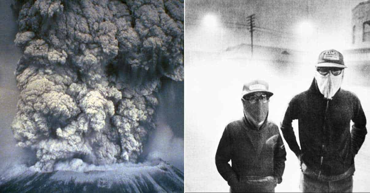
The eruption column shot 80,000 feet into the atmosphere and ash was spread over 11 states. Snow, ice, and entire glaciers melted, forming mudslides that traveled for 50 miles. The thermal energy released during the eruption was equal to 26 megatons. For comparison, the atomic bomb dropped on Hiroshima was 15 kilotons (0.015 megatons). The Mount St. Helens explosion was equivalent to 1,600 times the size of the atomic bomb dropped on Hiroshima
57 people were killed in the explosion. The explosion caused $3.03 billion in damage.
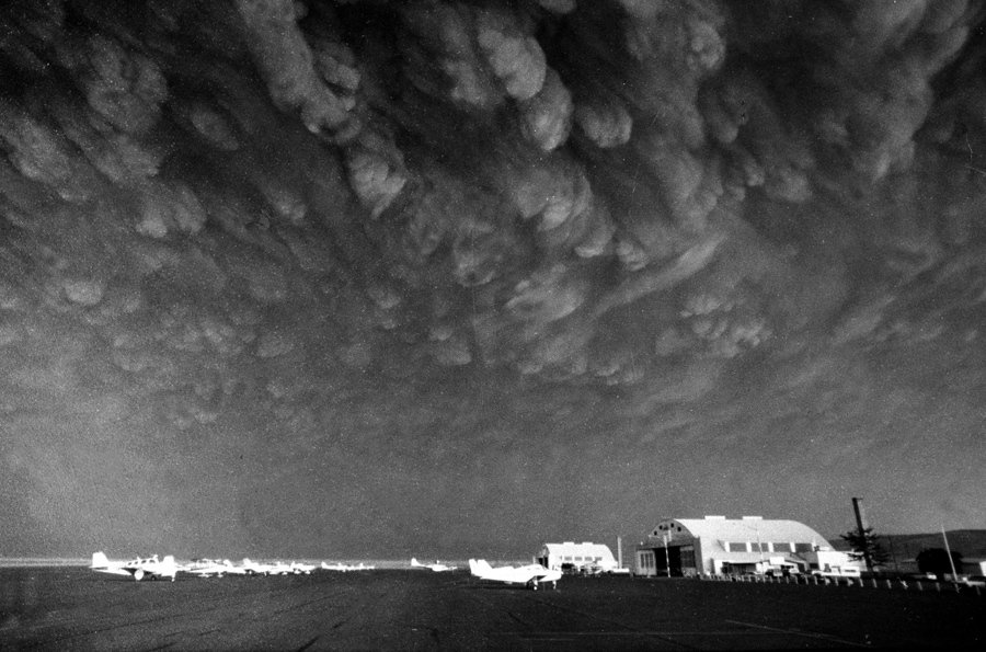
On May 17, 1980, volcanologist David Johnston sits at Coldwater II camp near Mt. St. Helens. At 8:32 a.m. the next morning, Johnston radioed a message to the USGS headquarters: “Vancouver, Vancouver, this is it!” Johnston did not survive the eruption. Coldwater II was later re-named “Johnston Ridge” in honor of Johnston. USGS/ Harry GlickenMount St. Helens, as it looked the day before its massive eruption, on May 17, 1980. USGS Cascades Volcano Observatory, Harry GlickenThe first photograph of a series of images showing the May 18, 1980, eruption of Mt. St. Helens. Clearly visible in the first few images is the largest recorded landslide in history—the entire north face of the volcano sliding away following a shallow earthquake. The newly-exposed core of the volcano then erupted. The AtlanticThe second photograph of a series of images showing the May 18, 1980, eruption of Mt. St. Helens. Clearly visible in the first few images is the largest recorded landslide in history—the entire north face of the volcano sliding away following a shallow earthquake. The newly-exposed core of the volcano then erupted. The AtlanticThe third photograph of a series of images showing the May 18, 1980, eruption of Mt. St. Helens. Clearly visible in the first few images is the largest recorded landslide in history—the entire north face of the volcano sliding away following a shallow earthquake. The newly-exposed core of the volcano then erupted. The AtlanticThe fourth photograph in a series of images showing the May 18, 1980, eruption of Mt. St. Helens. Clearly visible in the first few images is the largest recorded landslide in history—the entire north face of the volcano sliding away following a shallow earthquake. The newly-exposed core of the volcano then erupted. The AtlanticThe fifth photograph in a series of images showing the May 18, 1980, eruption of Mt. St. Helens. Clearly visible in the first few images is the largest recorded landslide in history—the entire north face of the volcano sliding away following a shallow earthquake. The newly-exposed core of the volcano then erupted. The AtlanticThe sixth photograph in a series of images showing the May 18, 1980, eruption of Mt. St. Helens. Clearly visible in the first few images is the largest recorded landslide in history—the entire north face of the volcano sliding away following a shallow earthquake. The newly-exposed core of the volcano then erupted. The AtlanticThe seventh photograph in a series of images showing the May 18, 1980, eruption of Mt. St. Helens. Clearly visible in the first few images is the largest recorded landslide in history—the entire north face of the volcano sliding away following a shallow earthquake. The newly-exposed core of the volcano then erupted. The AtlanticThe eight photograph in a series of images showing the May 18, 1980, eruption of Mt. St. Helens. Clearly visible in the first few images is the largest recorded landslide in history—the entire north face of the volcano sliding away following a shallow earthquake. The newly-exposed core of the volcano then erupted. The AtlanticMount St. Helens erupts on May 18, 1980. APMt. St. Helens, May 18, 1980. NOAA News PhotoThe ash cloud produced by the eruption, as seen from the village of Toledo, Washington, 35 miles (56 km) away, northwest from Mount St. Helens. The cloud was roughly 40 miles (64 km) wide and 15 miles (24 km) high. WikipediaAsh clouds from Mount St. Helens move over Ephrata airport in Washington on Monday, May 19, 1980. Communities across central and eastern Washington were covered in 3-5 inches of gritty, fine, ash particles. Mike Cash/ APA house is submerged along the Toutle River which flooded in the aftermath of the eruption of Mount St. Helens on May 19, 1980. Area streams and rivers rose quickly as ice and snow on the volcano melted instantly. The AtlanticA logging operation along the Toutle River, Washington, about 20 miles from Mount St. Helens, in ruins after flooding from ice and snowmelt from the mountain, in May of 1980. The AtlanticBob Brown, left, and his brother John attempt to lead three horses to safety out of the Weyerhaeuser 19 Mile camp in Kid Valley, Washington. The yard was flooded by the Toutle River following the eruption of Mount St. Helens. Gary Stewart/ APBob Brown (right) and John Brown climb onto a railroad car, heading down the train along with two additional would-be horse rescuers, giving up their efforts as they flee for their lives as flood waters from the Toutle River begin a sudden rise on May 19, 1980. All four people reached safety but the horses are presumed to have drowned. Gary Stewart/ APThe slopes of Smith Creek Valley, east of Mount St. Helens, show trees blown down by the May 18, 1980, lateral blast. Two U.S. Geological Survey scientists (lower right) give scale. The direction of the blast—shown here from left to right—is apparent in the alignment of the downed trees. Over four billion board feet of usable timber, enough to build 150,000 homes, was damaged or destroyed. Lyn Topinka/ USGAA Washington state geologist and a reporter walk toward the crater of Mount St. Helens in May of 1981, almost a year after the volcano exploded, causing dramatic destruction for miles around. They were near the steaming lava dome with the snow-covered crater wall beyond. Gary Stewart/ APA car sits submerged in ash in this May 20, 1980, photo from the Mount St. Helen eruption in Washington State. The AtlanticA National Guard member identifies victims of the eruption of Mt St Helens. USGS