Hell on Earth: 12 of History’s Most Destructive Natural Disasters

Hell on Earth: 12 of History’s Most Destructive Natural Disasters

Khalid Elhassan - October 10, 2017

The term “Mother Nature” often evokes warm and fuzzy feelings, bringing to mind loving and nurturing images, perhaps of green and grassy fields glistening with morning dew, rippling with the wind sighing through them, as the sun begins its daily journey through the blue skies above.

Or perhaps images of mountain crags overlooking wild valleys, through which rush rivers teeming with salmon, and whose banks are lined with cuddly bears and their cubs feasting and fattening themselves on Mother Nature’s bounty, while majestic eagles soar above, stooping into the occasional dive to strike the water and emerge clutching a wriggling fish in their talons.

On the other hand, sometimes Mother Nature can be a real mean mother, violent and seemingly psychotic, out to suddenly kill us by the thousands, or even millions, with little or no warning. She does that via natural disasters, sudden events that wreak extensive havoc and widespread devastation, and often significant loss of life as well as great financial loss.

Such natural disasters might result from severe storms, earthquakes, volcanic eruptions, flooding, landslides, or any other means of great destruction that are not controlled by human beings or caused by human action.

Following are twelve of history’s most remarkable natural disasters that occurred before the 20th century.

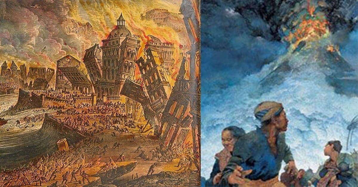
Second Millennium Thera Eruption

Hell on Earth: 12 of History’s Most Destructive Natural Disasters
Illustration showing the shape of Thera, modern Santorini in the Aegean Sea, before and after the Thera eruption. Science Photo Library

The Thera Eruption, circa 1642 – 1540 BC in what is today the Greek island of Santorini, was one of the most powerful volcanic eruptions in recorded history, four times as powerful as the gigantic Krakatoa explosion of 1883. It sundered the island of Thera, and wiped out the flourishing Minoan settlement of nearby Arkotiri and surrounding islands, giving rise to the legend of the vanished civilization of Atlantis, which was doomed by a natural catastrophe and swallowed by the sea.

Beyond legend, however, Thera’s eruption was one of history’s most impactful natural disasters, with consequences not only to its own era but with knock-on effects and a chain of causation leading directly to the world in which we live today.

In addition to the immediate devastation of Thera and surrounding islands, the eruption produced powerful tsunamis that devastated Crete, contributing to the decline of its Minoan civilization and paving the way for its extinction. The Minoans were the Mediterranean’s greatest naval power, as well as the dominant power of the Aegean, including what became Greece and the Greek world.

A trading power, the Minoans were oriented towards Egypt and the Eastern Mediterranean and were strongly influenced by those civilizations. While the Minoans flourished, the Aegean world in their thrall was by necessity oriented in the same direction, and strongly influenced by the Egyptian and eastern civilizations as well.

The Thera eruption weakened Crete and the Minoans sufficiently to create a power vacuum in the Aegean, which was filled by the emerging Mycenaeans in mainland Greece. They went on to conquer Crete and destroy the Minoans and became the dominant power of the Aegean. However, unlike the Minoans, the Mycenaeans’ energies were focused not on trade with Egypt and the Levant, but on the Aegean, the western coast of Asia Minor, the Black Sea coast, and would set the stage for future Greek colonization efforts in those regions, as well as the western Mediterranean.

That change of orientation significantly reduced Egyptian and eastern influences upon the Greeks, and when the Greek world flourished centuries later, long after the Mycenaeans had themselves disappeared, it would do so as a civilization and culture distinct from those of Egypt and the eastern Mediterranean, rather than as extension and outpost of those civilizations.

And since western civilization is founded upon that of the ancient Greeks, an argument could be made that today’s western civilization and its impact on the modern world would not exist but for the Thera eruption of the mid 2nd millennium BC.

Hell on Earth: 12 of History’s Most Destructive Natural Disasters
Still from the movie Pompeii, depicting Vesuvius’ eruption in 79 AD. Fans Pop

Vesuvius, 79 AD

One of antiquity’s most famous natural disasters, Mount Vesuvius’ eruption around noon on August 24th, 79 AD, was one of Europe’s most powerful volcanic explosions. Vesuvius blew its top with a force 100,000 times greater than that of the Hiroshima and Nagasaki atomic bombs, and the eruption tossed deadly debris mixed with a cloud of poisonous gasses over 20 miles up into the air.

As it spewed gasses into the air, lava and hot pumice poured out of the volcano’s mouth at a rate of 1.5 million tons per second, racing down Vesuvius’ side to devastate the surrounding region and destroy nearby towns, of which Pompeii and Herculaneum are the best known.

Pliny the Younger, a Roman author and magistrate, was 15 miles away at Cape Misenum, visiting his uncle, Pliny the Elder – a Roman admiral who would lose his life during the course of rescue efforts. To Pliny’s detailed description of the events he saw and those told him by first-hand witnesses, comprising the best written and most thorough narrative of the event, history is deeply indebted.

There had been tremors for days, but they were not unusual. Then, around noon on August 24th, a cloud appeared atop Vesuvius, and about an hour later, the volcano erupted and ash began to fall on Pompeii, 6 miles away. By 2 PM, pumice, or volcanic debris, begin to fall with the ash, and by 5 PM sunlight had been completely blocked and roofs in Pompeii began collapsing under the accumulating weight of ash and pumice. Panicked townspeople rushed to the harbor seeking any ship that would take them away.

By midnight, the volcano was spewing a hot deadly column over 20 miles up into the air, while lava flowed down its side in six major surges as Vesuvius vomited molten rock in a rapid flow that incinerated all that it encountered. The lava did not reach Pompeii or Herculaneum, but it sent heat waves of more than 550 degrees Fahrenheit into those towns, turning them into ovens and killing any who had not yet escaped and had not already suffocated from the fine ash.

About 1500 bodies were found in Pompeii and Herculaneum when they were unearthed centuries later. Those 1500 bodies were recovered from but a small area of that impacted by the volcano’s eruption and extrapolating to the surrounding regions, total casualties are estimated to have been in the tens of thousands.

Hell on Earth: 12 of History’s Most Destructive Natural Disasters
Ash and pumice dispersal from the 79 AD Vesuvius eruption. Wikimedia, by MapMaster – Own work, CC by SA 3.0

The towns of Pompeii and Herculaneum, whose populations at the time numbered about 20,000, were buried beneath up to 20 feet of volcanic ash and pumice. Tragic and terrifying as that was, the ash deposits did a remarkably effective job of preserving those towns nearly entire, thus affording future historians an unrivaled snapshot of 1st century AD Roman architecture, city planning, urban infrastructure, and town life in general.

Read More: Things You Didn’t Know About the Tragic Town of Pompeii and the Volcanic Eruption That Destroyed It.

Hell on Earth: 12 of History’s Most Destructive Natural Disasters
115 Antioch earthquake. Listverse

115 Antioch Earthquake

On December 13th, 115, the city of Antioch in the Roman province of Syria, modern Antakya in Turkey, was rocked by an extremely intense earthquake that caused widespread devastation and high loss of life in the region, destroying not only Antioch, but also the nearby city of Apamea, and inflicting significant damage upon Beirut as well.

The tremors also triggered a tsunami that slammed into the eastern Mediterranean coast and caused extensive damage as far south as the seaport of Caesarea in the Roman province of Palestine, whose harbor was wrecked by the wall of water. It is estimated that about 260,000 people lost their lives, with many more injured and/or made homeless.

Antioch at the time was a flourishing and economically vibrant Greco-Roman city on the Orontes river and was the Roman Empire’s third-biggest metropolis after Rome and Alexandria. The city owed its success to its location at the closest terminus of the Persian Royal Road linking the Mediterranean with Mesopotamia and Persia, making it a trading center and entrepot for goods between the Roman and Persian worlds.

Unfortunately, Antioch’s location also had the misfortune of being near the junction of three tectonic plates – the African, Anatolian, and Arabian – whose friction made the region particularly susceptible to large earthquakes.

As described by the Roman historian Cassius Dio, a loud and bellowing roar preceded the earthquake, after which the ground started to violently vibrate and shake, tossing people and entire trees up into the air as if they were water drops shaken off a wet dog’s fur, and lifting buildings off the ground and slamming them back to earth.

Many were killed or injured by falling debris, and many more still by buildings collapsing atop and burying them. The aftershocks, which continued for days, killed and injured many survivors of the first day’s tremors.

When the earthquake struck, the Roman emperor Trajan and his chief deputy and successor, the future emperor Hadrian, were wintering in Antioch, overseeing preparations for a military campaign against Parthia. Because Antioch served as headquarters for the war against Parthia, the city and the surrounding region were even more crowded than usual, due to the presence of legions encamped nearby, as well as the camp followers and other civilians engaged in support activities for the Roman army.

The emperor Trajan managed to escape via a window from the building in which he had been housed, and was fortunate to suffer only light injuries. As buildings and debris kept falling due to aftershocks, the emperor and his entourage relocated to the open hippodrome, or race track, where they erected tents and set up house.

His deputy Hadrian also escaped with only slight injuries, and both set to overseeing the recovery and rebuilding process, which was begun by Trajan, and after his death in 117, continued and completed by his successor, Hadrian.

Hell on Earth: 12 of History’s Most Destructive Natural Disasters
A tsunami caused by the 365 Crete earthquake reached as far as the North African coast, where it submerged parts of the port city of Appollonia, in today’s Libya. Wikimedia

365 Crete Earthquake

Early in the morning of July 21st, 365, the Roman world was rocked by a powerful earthquake registering at least 8 on the Richter Scale and epicentered on Crete. The earthquake, which shook the island and brought about widespread devastation, was the most powerful seismic upheaval to have struck the region in recorded history. In one gigantic push from below, coral reefs surrounding Crete erupted 33 feet upwards, clear of the water, and geologists estimate that the island was itself lifted by as much as 30 feet.

In addition to the immediate damage resulting from the earthquake, the tremors caused a powerful tsunami that wrecked not only much of the Cretan coast, but raced across the Mediterranean, wreaking havoc across that sea. The tsunami struck Greece to the north, Cyprus to the east, reached south to devastate coastal communities along the North African coast in Alexandria, Egypt’s Nile Delta and Libya, and raced westward to cause damage in Sicily and in far off Spain. The wall of water was high enough and powerful enough that it carried ships and hurled them up to two miles inland.

The earthquake and tsunami were described by many writers of the period. However, the quality of literary writing and intellectual discourse had significantly declined – the days of the high-quality prose of a Thucydides, Cicero, Caesar or Livy, were centuries past by then. Writers of Late Antiquity tended to describe events without paying as much attention to the details and actually describing them, as much as they did to ascribing their occurrence to divine displeasure and intervention from up above in response to political and religious events on earth.

Between that literary decline and religious antagonisms giving rise to intellectually dishonest descriptions, such as attributing the Cretan disaster to heavenly wrath, most of what we know is derived from archeological evidence, combined with numerous references to the earthquake’s occurrence and its massiveness.

The historian Ammianus Marcellinus‘ described the impact on Alexandria: “The solidity of the earth was made to shake … and the sea was driven away. The waters returning when least expected killed many thousands by drowning. Huge ships perched on the roofs of houses … hurled miles from the shore“.

Such descriptions however were rare, and the historical records lack a reliable contemporary narrative describing the damage elsewhere in the Mediterranean with the degree of attention that was common when Greco-Roman civilization and culture were at their height. There was no equivalent to Pliny the Younger’s description of the Vesuvius eruption of 79 AD. What is known is that the devastation caused by the earthquake and tsunami was massive and widespread, and the loss of life high, with estimated casualties between 300,000 to half a million.

Hell on Earth: 12 of History’s Most Destructive Natural Disasters
Aleppo’s citadel, which was severely damaged during the 1138 earthquake. Al Araby

1138 Aleppo Earthquake

The city of Aleppo in northwestern Syria lies on a geologic fault line separating the tectonic Arabian Plate from the African Plate, and the friction between those plates renders Aleppo and the surrounding region particularly susceptible to devastating seismic events. On October 11th, 1138, one of history’s deadliest earthquakes shook northern Syria and killed about 230,000 people in Aleppo, its environs, and the surrounding region.

Aleppo was a bustling and vibrant city during the Medieval era, but in the mid 12th century, the region was ravaged by war as the recently formed Crusader states, such as the nearby Principality of Antioch, vied with the neighboring Muslim states. Aleppo, then part of the Zengid Sultanate, was at the forefront of the anti-Crusader resistance, protected by strong walls and a powerful citadel.

On October 10th, 1138, a small quake shook Aleppo, and warned by the foreshocks, most of Aleppo’s population fled the city for the countryside. Many died there when the main earthquake struck the following day, but far more would have perished had they remained in the city. There, the powerful citadel suffered extensive damage from the tremors that caused its walls to fall down, while in the city below, most of Aleppo’s houses collapsed.

The devastation extended beyond Aleppo and was widespread throughout northwestern Syria. The town of Harem, conquered by Crusaders who fortified it with a strong citadel, was particularly hard hit by tremors that shook apart and demolished its castle and caused the local church to fall upon itself.

The nearby Muslim fort of Atharib also had its citadel destroyed by the earthquake, which caused it to collapse upon and kill 600 of its garrison. The border town of Zaradna, sacked and pillaged multiple times as it changed hands between the combatants, was wholly obliterated.

Hell on Earth: 12 of History’s Most Destructive Natural Disasters
A meteor shower. Force to Know

1490 Ch’ing Yang Meteor Shower

When streams of cosmic debris known as meteoroids enter Earth’s atmosphere at high speeds, simultaneously and on parallel trajectories, the transition from the airless vacuum of space to the increasingly dense atmosphere of Earth causes them to burn and disintegrate, producing meteor showers. Streaking the night skies, especially on clear and starry nights, meteor showers are among the most breathtakingly beautiful celestial sights. Usually.

In 1490, in Ming Dynasty China, meteor showers stopped being breathtakingly beautiful to the good people of Ch’ing Yang in Shaanxi (today’s Gansu Province), who witnessed one such shower suddenly go from the delightfully picturesque to the horrific, when one of the falling objects burst in the air during atmospheric reentry, killing thousands. As described by Chinese records of the era, during an intense meteor shower:

Stones fell like rain in the Ch’ing-yang district. The larger ones were [about 3.5 pounds], and the smaller ones were [about 2 pounds]. Numerous stones rained in Ch’ing-yang. Their sizes were all different. The larger ones were like goose’s eggs and the smaller ones were like water-chestnuts. More than 10,000 people were struck dead. All of the people in the city fled to other places.

There are similarities between Chinese source descriptions of the 1490 event and what is known of the 1908 Tunguska event, when an airburst of a meteoroid at an altitude of 5 miles above a sparsely populated part of Siberia flattened 770 square miles of forest. As such, it is likely that that the deadly 1490 Ch’ing Yang meteor shower was caused by the disintegration of an asteroid in an airburst during atmospheric entry.

Hell on Earth: 12 of History’s Most Destructive Natural Disasters
A yaodong/ cave house city carved into a hillside in Shaanxi. Wikimedia

1556 Jiajing Earthquake

China’s Loess region, the cradle of its civilization, is highly susceptible to earthquake damage because loess soil – rich windblown silt that settled over the millennia to depths of up to 300 feet – readily disintegrates when subjected to seismic activity. Between that vulnerability and China’s high population density throughout history, many of the world’s most devastating earthquakes have occurred in China.

On the morning of January 23, 1556, Ming Dynasty China was rocked by the deadliest earthquake in human history, registering around 7.9 on the Richter scale and epicentered in the Wei river basin in the Jiajing region, or modern Shaanxi.

Fissures up to 70 feet deep were opened in the earth, as the ground suddenly rose up in some place to form new hills, while in other places hills crumbled and subsided into valleys. 97 counties in Shaanxi and surrounding provinces were devastated, as the earthquake destroyed nearly everything within an area more than 500 miles wide, and damage was inflicted as far as 310 miles from the epicenter.

Recurring aftershocks continued for six months, and in many counties within the zone of destruction, over 60% of the population was killed outright, with many of the remainder injured, and all the survivors left without shelter. The loss of life was particularly high because most of the population in Shaanxi and surrounding regions, taking advantage of the region’s soft loess soil, built their homes out of earth shelters known as yaodongs – a form of artificial cave carved out of hillsides.

Such houses have the advantage of being cool in the summer and warm in the winter, but they had the disadvantage of being particularly vulnerable to seismic activity. When the 1556 earthquake struck, they collapsed, with not only the weight of a roof falling upon the inhabitants, but an entire hillside falling on and burying whole communities. When it was over, around 830,000 had been killed, and millions more were injured and/or rendered homeless.

Hell on Earth: 12 of History’s Most Destructive Natural Disasters
1755 Lisbon earthquake and tsunami, with the extent of the tsunami’s dispersal in hours. Wikimedia

1755 Lisbon Earthquake

On the morning of November 1, 1755, just as it began celebrating the religious festival of All Saints’ Day, the Portuguese capital of Lisbon – at the time one of Europe’s wealthiest cities and busiest seaports – was almost completely demolished by a powerful earthquake of a magnitude 9.0, whose shocks were felt as far away as Finland, North Africa, and even the Caribbean.

Striking around 9:40 AM, the upheaval caused fissures nearly 20 feet deep to open in the city’s streets, and because of the religious festival, a significant percentage of the population were gathered in churches and cathedrals when the tremors began, and thousands were crushed to death as the houses of worship collapsed atop them. As the tremors subsided, another danger arose as fires erupted around the city, first individually then joining together until most of Lisbon was a giant inferno.

Shaken and frightened survivors, seeking to escape the conflagration and collapsing buildings, rushed towards the harbor, where the large open squares of the royal palace promised safety from both flames and falling debris. There, they were further alarmed when they encountered the incongruous sight of a harbor without water, with ships resting on a dried seabed.

Gathering in the drying silt of the harbor’s bottom, they were led by priests in fervent prayers beseeching God’s mercy and forgiveness of whatever sins had occasioned such divine wrath. Many were still praying and begging God’s mercy in the harbor when the sea returned with a vengeance in the form of a tsunami, with a wall of water 40 feet high, and drowned them.

Total casualties are estimated to have been as high as 60,000 deaths in Lisbon alone, with a total of perhaps 100,000 deaths or more in the Lisbon region, plus many more injured. The earthquake occurred as the Enlightenment was getting into full swing, and inspired significant philosophical discourse and exchanges that furthered the development of theodicy, or the question of how a just and good God could allow what happened in Lisbon to take place.

The thorniest theodicy question was why God had sent an earthquake to crush His worshippers by the thousands in cathedrals and churches as they gathered in prayer to celebrate All Saints Day and glorify His name. The question was compounded and made thornier yet by His subsequent sending of a tsunami to drown the survivors who had been praying for His mercy in Lisbon’s harbor.

Hell on Earth: 12 of History’s Most Destructive Natural Disasters
Laki today. Wired

1783 Laki Eruption

The Laki eruption of 1783 was not one of history’s most powerful volcanic events – it was not a massive and violent eruption like Vesuvius or Krakatoa or Tambora, or what most people imagine when picturing a volcano going off with a bang, blowing its top, and releasing a massive amount of energy in a dramatic explosion with fires reaching to the heavens and rivers of lava rushing down the volcano’s sides.

Indeed, the Laki eruption was not even a single explosive event, but rather 8 months of rumblings, interspersed by relatively small eruptions from time to time, with lava slowly seeping out of the side every now and then, while the volcano steadily spewed sulfuric dioxide gasses. Laki was not a vigorous and energetic volcano, but a tired and lazy one, steadily farting gasses for 8 months before it finally subsided and went quiet. Nonetheless, Laki was the deadliest volcanic eruption in human history.

Its deadliness was a result of its steady release, during its 8 months of rumbling and periodic small explosions, of massive amounts of gasses, including fluorine and over 120 million tons of sundry sulfuric dioxides, which produced fog and haze as far away as Syria. The fluorine settled on Iceland’s grass, which gave grazing animals fluoride poisoning and killed most of the island’s livestock. The loss of livestock, in turn, caused a quarter of Iceland’s human population to starve to death.

But Iceland was and remains sparsely populated, so the death of a quarter of its population did not make Laki history’s deadliest eruption. Beyond Iceland, the eruption led to a decline in temperatures in the northern hemisphere – winter temperatures in the US, for example, dropped 10 degrees Fahrenheit in 1783, and remained below normal for several years afterward. Laki’s deadliest impact was not in the US or North America, however.

The deadly impact was in Europe and the northern hemisphere to the southeast of Iceland. The summer of 1783 had been a particularly hot one, and a rare high-pressure zone formed over Iceland that year, which caused winds to blow to the southeast. Thus, when Laki began spewing prodigious amounts of sulfuric dioxide into the sky, they were carried by the winds from Iceland in a southeasterly direction, where they caused crop failures in Europe, draught in North Africa and India, Japan’s worst famine, as well as a historic famine in Egypt, a sixth of whose population starved to death in 1784.

It is estimated that the Laki eruption and its aftermath caused the deaths of an estimated six million people, making it the deadliest volcanic eruption in human history, and illustrating that low energy but large volume eruptions over an extended period can have a greater impact than massive explosive eruptions.

Hell on Earth: 12 of History’s Most Destructive Natural Disasters
1815 Tambora eruption. Smithsonian Magazine

1815 Tambora Eruption

The eruption of Mount Tambora on Sumbawa Island in the Dutch East Indies (today’s Indonesia), which climaxed on April 10th, 1815, was the most powerful volcanic explosion of the past 10,000 years. It began on April 5, when the first loud eruption occurred with a thunderous clap that was heard nearly 1000 miles away. Over the next few days, the volcano steadily steamed, while emitting faint detonation sounds.

Then, on April 10, people in Sumatra, 1600 miles away, were startled to hear what sounded like cannons going off. Tambora had finally gone off, instantly killing about 12,000 inhabitants of Sumbawa Island in a cataclysmic explosion, while about another 80,000 died in the region from famine and starvation after falling ash and pumice ruined their crops and fields.

On Sumbawa Island, the eruptions had grown more energetic early that morning. Flames rose up into the sky, and lava and glowing ash began pouring down the mountainside. By 8 AM, bits of pumice up to 8 inches wide were raining down, and ash spewed into the air so thickly that as far as 400 miles away, it was pitch dark for two days. The volcano poured rivers of incandescent ash down its sides to scorch the island, while its tremors sent tsunamis racing across the Java Sea.

Tambora spewed ash and 12 cubic miles of gasses hurtling up into the skies, causing extreme weather conditions around the planet. The fine ash dispersed throughout the atmosphere created optical phenomena worldwide, producing prolonged and brilliantly colored sunsets and twilights that were red or orange near the horizon, and pink or purple above.

The ashes in the atmosphere had another, less lovely impact, in that they brought about a volcanic winter, which lowered global temperatures and turned 1816 into what came to be known as The Year Without Summer. That led to an agricultural disaster of crop failures and food shortages in the northern hemisphere.

Among the unusual and extreme weather phenomena caused by Tambora was the impact thousands of miles away, on the far side of the planet in the eastern US. There, the spring and summer of 1816 were marked by a persistent dry fog that reddened and dimmed the sunlight. That May, a frost killed off most crops in upstate New York, as well as Massachusetts, Vermont, and New Hampshire, and snow fell as late as June 6 in Albany, NY. Other parts of the world also recorded weird weather phenomena that year.

Hell on Earth: 12 of History’s Most Destructive Natural Disasters
Aftermath of 1839 Coringa Cyclone. Monsters and Critics

1839 Coringa Cyclone

Until 1839, Coringa was a bustling port city on the Bay of Bengal near the mouth of the Godavari river in India’s east coast, with a population numbering in the hundreds of thousands, and a harbor that hosted thousands of ships annually, busily loading and unloading goods and produce. Today, Coringa is a tiny village near the coast, of no distinction or note, and a population of no more than a few thousand. The drastic decline was caused by a pair of devastating cyclones, one in 1789, and an even more destructive one fifty years later, in 1839.

After centuries of prosperity, Coringa’s fortunes took a hit in 1789, when a storm that came to be called The Great Coringa Cyclone developed in December of that year, fairly late in the cyclone season by Bay of Bengal standards. It produced severe storm-tide conditions, and witnesses described a succession of three giant waves striking Coringa, with the first storm tide driving ashore all the ships in Anchorage, while the second and third waves, even bigger than the first, flowed inland to inundate with saltwater the fertile fields of the Godavari river’s delta. The city of Coringa was almost completely destroyed, and around 20,000 people were killed.

Akin to those who named the 1914 – 1918 global war “The Great War“, little knowing that an even greater one would soon follow, those who named the 1789 storm the “Great Coringa Cyclone” did not suspect that an even bigger and far more devastating cyclone would strike Coringa within a lifetime. Fifty years later, by 1839, Coringa had recovered from the 1789 disaster and rebuilt, and was more prosperous, populous, and bustling than it had ever been.

Then, on November 25, 1839, again unusually late in the Bay of Bengal’s cyclone season, a monstrous cyclone struck Coringa and brought with it a 40-foot storm surge. The extensive damage of the earlier 1789 cyclone paled in comparison to this one, which wholly destroyed the city of Coringa, wrecked all ships in the harbor and carried their wreckage miles inland, and killed over 300,000 people.

This time the damage was so extensive that the few survivors made no effort to rebuild. Most upped stakes and scattered to pursue their lives elsewhere, putting distance between themselves and what was thought to be a cursed city. The few who remained, some of whom were old enough to have experienced both devastating cyclones during their lifetimes, abandoned the coast altogether and rebuilt their community miles inland.

Hell on Earth: 12 of History’s Most Destructive Natural Disasters
27th May 1883: Clouds pouring from the volcano on Krakatoa (aka Krakatau or Rakata) in south western Indonesia during the early stages of the eruption which eventually destroyed most of the island. Royal Society Report on Krakatoa Eruption – pub. 1888 Lithograph – Parker & Coward (Photo by Hulton Archive/Getty Images)

1883 Krakatoa Eruption

One of the best attested major eruptions of modern times occurred on Krakatoa Island, in the Sunda Strait between Java and Sumatra in the then Dutch East Indies (today’s Indonesia). Krakatoa, which had three linked volcanic peaks, began erupting on the afternoon of August 26, 1883 and peaked the following morning. By the time it stopped, most of Krakatoa Island and its surrounding archipelago had disappeared, collapsing into a caldera. Minor seismic activity continued for months afterward, before the volcano finally fell silent.

While the intensity and suddenness of the eruption were surprising, the eruption itself was not, for there had been plenty of warnings. For years, there had been intense seismic activity on Krakatoa, with earthquakes felt as far away as Australia. Three months before the dramatic explosion, beginning in May, the volcano started to vent steam and spew columns of ash up to 20,000 feet into the air, and give off explosions that were heard in Jakarta, 100 miles away.

That went on for a week, then quieted, before resuming again in mid-June, with a thick black cloud that covered the area for a week as the volcano erupted periodically, emitting ash and throwing up pumice that landed hundreds of miles away into the Indian Ocean.

That activity, in turn, increased tidal activity, with the results that ships had to be moored with strong chains to resist the tide’s suddenly strong ebb and flow. By early August, a desolate and abandoned Krakatoa was covered by nearly two feet of ash, and all vegetation had died, leaving only tree stumps.

The final act started early in the afternoon of August 26. By 2 PM, explosions could be heard every 10 minutes or so, and Krakatoa had spewed a 20-mile high ash cloud that was visible from far off, and ships up to 12 miles away reported a heavy ash fall, accompanied by bits of pumice up to 4 inches wide. By early evening, the seismic activity had given rise to mini tsunamis, which struck the Sumatran and Javan coasts 25 miles away.

The climax began early the following morning, with two big eruptions, at 5:30 and 6:44 AM on August 27th, which gave rise to tsunamis. That was followed at 10:02 AM by the loudest sound ever heard until then in recorded history: a cataclysmic explosion of about 180 decibels, that was equivalent to 15,000 Hiroshima bombs and that put the preceding eruptions to shame. It was heard nearly 2000 miles away in Perth, Australia, 3000 miles away on the island of Rodrigues, near Mauritius in the Indian Ocean, and produced a tsunami about 100 feet high in places.

Yet that was not the worst that Krakatoa had to offer. A fourth, and even more powerful eruption, occurred at 10:41 AM, nearly twice as loud as the previous one, at 310 decibels: so loud that it ruptured eardrums 40 miles away, and was clearly heard from 3100 miles away. A tsunami with a wall of water up to 120 feet high raced out, as ash was flung 50 miles up into the sky by an explosion that produced a pressure wave that was recorded in barometers all over the world.

Recorded on global barometers not once, but seven times, as the pressure wave raced around the planet for five days, circling the globe and coming back to the volcano, and continuing on, again and again, and again, still powerful enough to register on barometers everywhere on earth as circled the planet multiple times. The catastrophic eruptions and resultant tsunamis killed at least 36,000 according to official Dutch estimates, but modern estimates put the true casualty figures at up to 120,000.

Advertisement